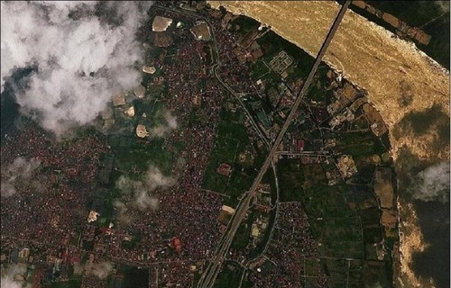
 An image captured by VNREDSat-1 An image captured by VNREDSat-1 |
VNREDSat-1 or Vietnam Natural Resources, Environment and Disaster-monitoring Satellite-1 is capable of taking pictures the earth's entire surface. The satellite with dimensions of 600 mm x 570 mm x 500 mm and a weight of 120 kg, developed by the Airbus Group, was launched into orbit on May 7, 2013.
The project was funded by the French Government’s ODA. The satellite’s lifespan of twice as long as expected is a testament to Airbus’ advanced technology and a demonstration of the effective training, transfer and reception between the Airbus Group and the Vietnam Academy of Science and Technology.
VNREDSat-1 consists of 1 satellite operating in orbit, 1 transceiver station controlled by S-band satellite in Hoa Lac, 1 station for data control and storage at the Vietnam Academy of Science and Technology, and 1 X-band image data collection station at the National Remote Sensing Department, Ministry of Natural Resources and Environment.
Since its launch, VNREDSat-1 satellite has enabled Vietnam to remotely monitor natural resources, the environment, natural disasters and other areas of concern. VNREDSat-1 satellite has effectively supported Vietnam's natural resources and environment sector to address challenges in forest and water resource management, disaster management, urban planning and mapping, as well as coastal management.
President of Vietnam Academy of Science and Technology Professor Academician Chau Van Minh said: ""During its 10 years of operation with more than 53,000 orbits around the earth, totaling 2.4 billion km, VNREDSat-1 has provided nearly 160,000 images over territories and territorial waters of Vietnam and the world. The satellite has enabled Vietnam to remotely monitor natural resources, natural disasters and areas of concern and gradually apply science and technology in monitoring and defending territorial sovereignty."