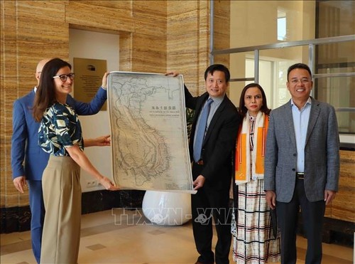
 Deputy Director of the Diplomatic Academy of Vietnam Nguyen Hung Son hands over the map of An Nam (the old name of Vietnam) to Simina Badica, an archival curator of the House of European History. (Photo: VNA) Deputy Director of the Diplomatic Academy of Vietnam Nguyen Hung Son hands over the map of An Nam (the old name of Vietnam) to Simina Badica, an archival curator of the House of European History. (Photo: VNA) |
The map was created by French Bishop Jean-Louis Taberd and published in Serampore, India, in 1838 in Chinese, Vietnamese, and Latin. All locations’ names on the map, including those in China, Laos, and Cambodia, were written in Vietnamese, while the footnotes were used in Vietnamese, Latin and French.
The archipelago in the East Sea has an administrative name Hoang Sa (written in Chinese), bishop Taberd also noted its popular name as Golden Sand (in Chinese-Vietnamese language), which the French called Paracel. The name Golden Sand in Vietnamese was only used in Dai Viet kingdom (from 1054 to 1400 and from 1428 to 1804) and in today's Vietnam.
The map also shows a cluster of islands in the middle of the East Sea, located in the north of the 160th parallel and east of the 1100 longitude, which writes: "Paracel seu Cat Vang" (Paracel or Golden Sand). This inscription confirms that the Paracel islands as called by Westerners are the Golden Sand islands (Cat Vang or Hoang Sa) as called by Vietnamese.
This proves that the French came to Vietnam and drew a map to identify Vietnam’s territory. The map will be displayed at the House of European History.